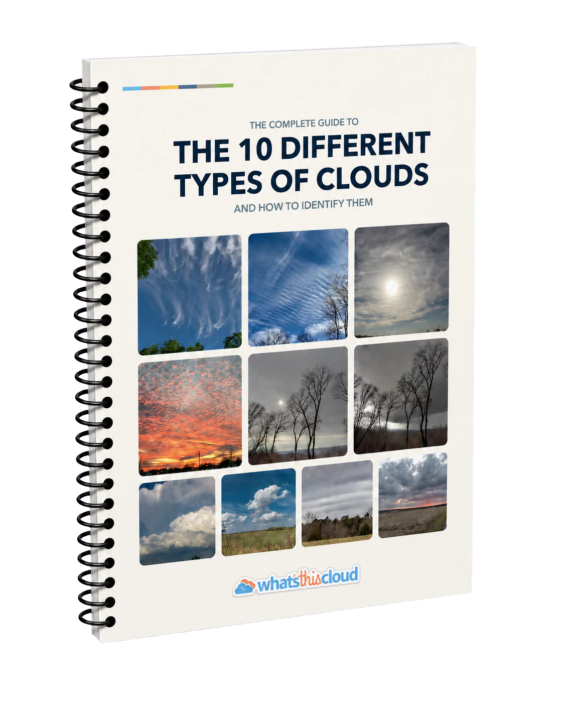
Learn everything you need to know about cloud identification and classification
Clouds are the equivalent of an ever-evolving painting in the sky. They have the ability to make for sunrises magnificent and sunsets spectacular. We’re surrounded by clouds almost every day of our lives. Doesn’t it seem like cloud identification should be something that comes naturally to us?
So why isn’t it? Maybe it’s because cloud names and terms are all in Latin, and Latin names scare us. Maybe it’s because we think we need a Ph.D. in Atmospheric Sciences or Meteorology (not true!). Whatever the reason is, this site has been created to do one thing: help you easily identify and classify all different types of clouds.
The information below was created as a comprehensive guide to cloud identification and classification. Consider this page an instruction manual to the rest of the site. Let’s get started! ⛅️
Start with the 10 cloud types
Every cloud is identified first by its genus, or main cloud type. The ten genera are commonly grouped by where their bases usually form. The boundaries overlap and vary by latitude; cumulus and cumulonimbus can grow through more than one level, and nimbostratus often spans several levels.

High-level clouds
Cirrus forms fibrous streaks, cirrocumulus forms small rippled patches, and cirrostratus forms a thin veil that may create a halo.
Middle-level clouds
Altocumulus forms rounded patches or rolls, altostratus forms a widespread gray layer, and nimbostratus forms a thick precipitation-bearing layer.
Clouds with low bases
Cumulonimbus grows into a storm cloud with strong vertical development, while cumulus forms detached puffy heaps. Stratus forms a uniform low layer, and stratocumulus forms broad layers of rounded masses.
Remember cloud types with five name roots
All ten cloud types are built from just five Latin roots: cirro-, cumulo-, strato-, nimbo-, and alto-. Think of these terms as building blocks. While they are clues rather than full descriptions, they tell you about a cloud's form, altitude, and whether it will produce rain. The better you understand these five terms, the easier cloud identification becomes.
Cirro- is translated from Latin meaning ‘curl’.
There are three clouds that include the term ‘cirro’: cirrus, cirrocumulus, and cirrostratus. While this term is translated as ‘curl’, that doesn’t mean these three clouds are curly (though cirrus clouds can be, which makes it an appropriate name). The more important takeaway from this term is that the three clouds that include the term ‘cirro’ are found in the highest layer of the troposphere, which is the lowest layer of the Earth’s atmosphere found closest to the ground. That means these clouds can be found between approximately 16,000 and 50,000 feet, or 5 and 15 kilometers.
Cumulo- is translated from Latin meaning ‘heap’.
There are five clouds that include the term ‘cumulo’: cumulus, stratocumulus, cumulonimbus, altocumulus, and cirrocumulus. Heap can also be described as piled or puffy. That means these five clouds have at least some puffy and heap-like characteristics to them.
Strato- is translated from Latin meaning ‘layer’.
There are five clouds that include the term ‘strato’: stratus, stratocumulus, nimbostratus, altostratus, and cirrostratus. A layer cloud can be described as a cloud blanket that has much less definition relative to a heap cloud. The five clouds listed here are generally featureless clouds relative to other clouds.
Nimbo- is translated from Latin meaning ‘rain’.
There are only two clouds that include the term ‘nimbo’: cumulonimbus and nimbostratus. These two genera are the principal clouds associated with substantial precipitation, although other cloud types can also produce rain, drizzle, or snow.
Alto- is translated from Latin meaning ‘high’.
There are only two clouds with the term ‘alto’: altocumulus and altostratus. The translation can be a bit deceiving because these clouds aren’t the clouds found in the highest part of the troposphere. Altocumulus simply means they’re still cumulus clouds, but they’re found higher than regular cumulus clouds. Similarly, altostratus means they’re still stratus clouds but found higher than stratus clouds. These clouds can be found between approximately 7,000 and 23,000 feet, or 2 and 7 kilometers.
Approaches to identifying clouds
Cloud identification works by narrowing the possibilities, not by finding one magic clue. Two visual approaches make the ten cloud types easier to organize: first compare the cloud-base level, then compare its overall form.
- Base level
- Overall shape
- Sky coverage
- Vertical growth
- Precipitation
- Texture and light
Group clouds by level
Estimate where the cloud base sits relative to the ground. Levels overlap and vary by latitude, so use height as a clue, not an exact measurement.
CirrusCirrocumulusCirrostratus
Look for fibrous streaks, tiny rippled patches, or a thin veil across the sky.
AltocumulusAltostratusNimbostratus
Look for rounded patches or broad layers. Nimbostratus is usually found here but commonly extends into the levels above and below.
CumulonimbusCumulusStratusStratocumulus
Look for low layers, rounded masses, puffy heaps, or towers. Cumulus and cumulonimbus can grow through multiple levels.
Group clouds by visual form
Use the Latin name roots as visual building blocks. Decide whether the cloud looks layered, heaped, mixed, precipitation bearing, or wispy.
Three layer clouds
CirrostratusAltostratusStratus
Blanket-like sheets at high, middle, and low levels.
Three heap clouds
CumulusAltocumulusCirrocumulus
Rounded heaps or patches at low, middle, and high levels.
Two primary rain clouds
Widespread steady precipitation versus showers and thunderstorms. Other cloud types can also precipitate.
Use both approaches together
Start with the whole sky, estimate the cloud-base level, match the broad form, and then confirm the result with supporting clues.
- Scan the whole sky. Notice whether you are looking at one cloud, a patch, or a continuous layer.
- Estimate the cloud-base level. Treat high, middle, or low as a clue rather than an exact measurement.
- Match the broad form. Compare the cloud with the layer, heap, mixed, precipitation, or wispy group.
- Confirm with supporting clues. Check coverage, vertical growth, precipitation, texture, shading, and optical effects.
Exact altitude usually cannot be judged from one photograph, and more than one cloud type may share the same sky. Clouds also evolve from minute to minute, so the best match may change as a cloud grows, merges, or dissipates. Stop when the evidence stops: a confident cloud type is more useful than a forced classification.
Build a full cloud classification
This is where more advanced Cloudspotting begins. Identifying one of the ten cloud types is the foundation; the fun of more cloud classification is adding subtype terms that describe exactly what you see. Beyond the ten cloud types, 44 additional Latin terms can refine a cloud's name: 15 species, 9 varieties, 11 supplementary features, 4 accessory clouds, and 5 other clouds or origin terms. They describe a cloud's shape, arrangement, transparency, visible features, companions, and how it formed.
Six steps to naming clouds by their full name
Work from the main cloud type toward the more specific details. Each colored stage links to the complete guide for that classification category.
- CloudTypesChoose 1
- CloudSpeciesChoose up to 1
- CloudVarietiesApply multiple if applicable
- SupplementaryFeaturesApply multiple if applicable
- AccessoryCloudsApply multiple if applicable
- OtherCloudsApply multiple if applicable
Follow the hierarchy without forcing every step
A cloud may be named only by its type. It is perfectly accurate to stop at cirrus or cumulus when that is all the evidence supports. No more than one species applies to a cloud at a time, while multiple compatible varieties, supplementary features, accessory clouds, and other terms may apply.
Add a subtype only when it improves the name
For example, calvus is a species used only with cumulonimbus when its developing top does not yet show clearly fibrous or striated features. If the cloud type is clear but the subtype is not, leave the uncertain term off. A shorter accurate name is better than a longer forced one.
Download a printable cloud identification chart
Use the one-page cloud chart to compare the 10 cloud types and see which species, varieties, supplementary features, and accessory clouds can be paired with each type.
Get the cloud identification chart
Cloud classification isn't always black and white
Learning examples often show only high, wispy cirrus or one perfectly structured cumulonimbus cloud against an empty sky. That clarity is useful, but the real sky rarely holds still or sorts itself into tidy categories.
01 · Mixed skies
Textbook clarity meets real-world complexity
Most days bring layers, heaps, wisps, and in-between forms at the same time. Scan the entire sky before naming one part of it, and expect different cloud types, species, and varieties to overlap.
02 · Time changes the answer
Clouds never hold a pose
A growing cumulus can deepen, spread, or develop storm features within minutes. The best-fitting species, or even cloud type, can change as the cloud evolves.
03 · Viewpoint changes the evidence
Classification depends on where you stand
A thunderstorm 30 miles away may reveal different clues than it does from 10 miles away. Distant cirrus can also look unlike the same clouds seen from below. Name only what your viewpoint lets you see.
See cloud classification in action
Let's take everything we've learned above and use it in real-life examples. We'll look at two different clouds and walk through the thought process of classifying each one.

Example 1
A foggy, dreary morning
Above is a scene of a road where visibility is decreased from a low-hanging cloud which is practically touching the ground. This is a low-level cloud. If you remember, the four clouds that are found in the lowest level are cumulus, stratocumulus, stratus, and cumulonimbus. But this cloud has no detail. It's a blanket cloud and a featureless layer, which is the perfect description of a stratus cloud.
But to further describe this stratus cloud, let's investigate which cloud species might be applied. Stratus clouds can be associated with the fractus cloud species and nebulosus cloud species. Fractus describes clouds that are ragged and broken up, while nebulosus describes clouds that are full of vapor and lack detail.
While it's not always necessary to apply a cloud species to an observation, this cloud lacks any kind of detail whatsoever. The species nebulosus would be applied here.
Next, let's see if there are any cloud varieties that might be applied. Stratus clouds have three associated cloud varieties: opacus, Latin for opaque; translucidus, Latin for translucent; and undulatus, Latin for undulating. In this example, the cloud appears thick enough to sufficiently block out the Sun. The cloud isn't translucent, and it's not undulating. In this case, it's appropriate to apply the opacus cloud variety.
Let's see if there are any supplementary features that might be applied. Stratus clouds have two associated supplementary features: fluctus and praecipitatio. Fluctus describes clouds with wave formations, while praecipitatio is the Latin term for precipitation. This cloud has neither, so there isn't a need to apply a feature to it.
Finally, stratus clouds don't have any associated accessory clouds, but they do have several other clouds associated with the cloud type: cataractagenitus, a cloud created from waterfalls; homogenitus, a cloud created from human activity; and silvagenitus, a cloud created from forest evaporation. This cloud has none of these three.
Classification: Stratus nebulosus opacus (St neb op).
In this example, we determined the cloud classification starting from the cloud type and working our way down through cloud species, varieties, features, and accessories taxonomy. In the next example, we'll work backward by identifying a cloud feature first instead of the cloud type.



Example 2
A warm, muggy afternoon
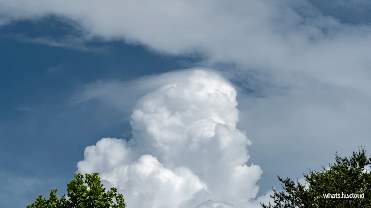
Above is a scene of a puffy cloud in the distance towering over some trees in the foreground. Notice something interesting about this cloud? The most distinct aspect of the cloud pictured is the smooth cap that sits overtop the tower. This cloud is recognized as a pileus accessory cloud.
Knowing what the accessory cloud is can be helpful in deciding the cloud type and ultimately classifying the cloud. Of the ten cloud types, only two are capable of creating a pileus accessory cloud: cumulus and cumulonimbus.
As we decide between these two cloud types, consider the differences between cumulus and cumulonimbus clouds. If the cloud has precipitation or lightning, you would be observing a cumulonimbus cloud, or thunderstorm. In this case, the cloud is definitely growing, but there's no sign of rain or lightning. We'll ultimately decide the cloud is a cumulus cloud.
But the cloud is tall. It's not your ordinary puffy cumulus cloud. It's towering and seemingly on the rise. This is an ideal example of cumulus congestus, the cloud species describing a cumulus cloud that is taller than it is wide.
Before finalizing the official classification, double check to see if any other cloud varieties, features, or accessories can be applied. Cumulus clouds have one variety, radiatus, sometimes known as cloud streets, which doesn't apply in this case. Cumulus clouds also have five associated supplementary features: arcus, fluctus, praecipitatio, tuba, and virga. This cloud has none of these, so there isn't a need to apply a feature.
Cumulus clouds also have three associated accessory clouds: pannus, pileus, and velum. We've already decided it has a pileus accessory, but pannus and velum don't apply.
Classification: Cumulus congestus pileus (Cu con pil).
In this example, we determined the cloud classification starting from an accessory cloud and working backward to determine its ultimate classification. As you become more familiar with cloud species, varieties, features, and accessories, it becomes easier to identify clouds without necessarily recognizing the cloud type first.
This example should get you more excited for cloud species, varieties, features, and accessories. They're pieces of the puzzle that help you put it all together.


Practice cloud identification
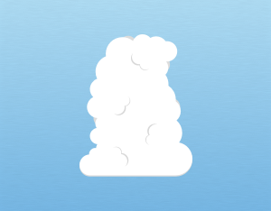
Clouds are an ever-evolving painting in the sky. The quickest way to improve is to look up often, identify the genus first, and use process of elimination when two clouds seem similar. Compare what you see with real photographs and illustrations, then add species, varieties, or features only when they make the description more precise.
Photograph the context
Take one wide photograph that includes the horizon and surrounding sky, then a closer image showing texture and cloud edges. Note the time, location, precipitation, and how the cloud changes over the next several minutes. A tightly cropped photograph can hide scale, coverage, and nearby cloud layers.
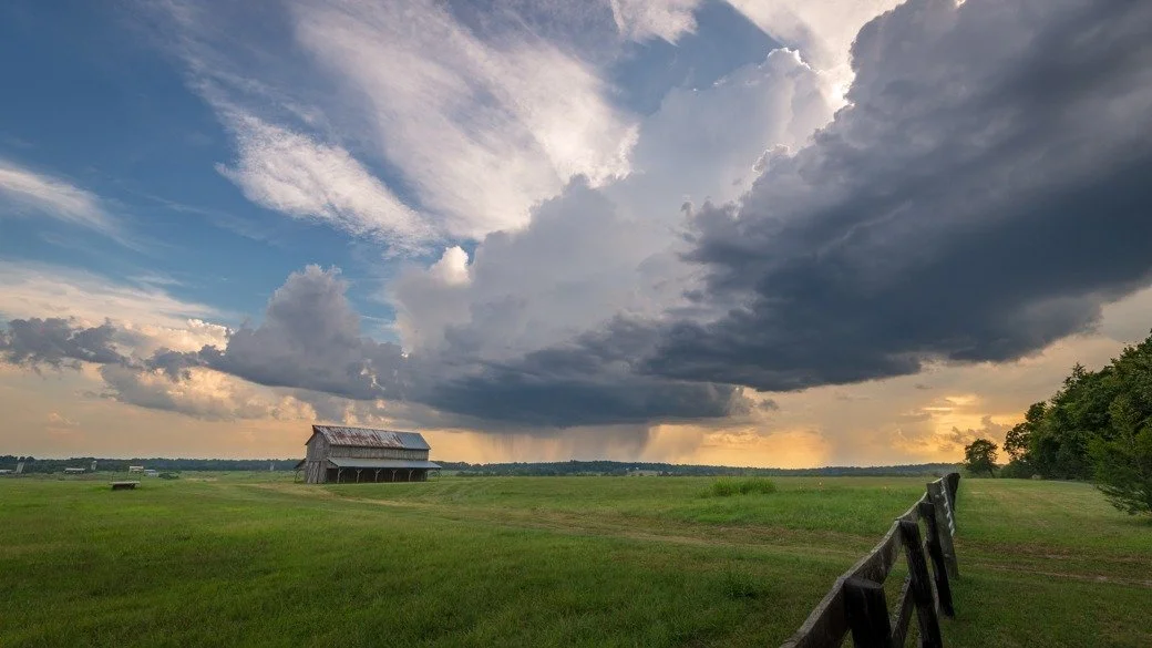 Cloud identification lessonsWork through real photographs and follow each classification step by step.
 The 10 cloud typesCompare the names, levels, illustrations, and identifying clues for every cloud genus.
 Follow on InstagramFollow What's This Cloud on Instagram for new cloud photographs, identification tips, and weekly field notes.